

In June 2025, archaeologists running a rescue excavation ahead of a business park near Carnac, in Brittany, pulled nearly fifty radiocarbon samples out of the ground and did something nobody had managed in two centuries of digging at the site: they put a reliable date on the stone rows. Several sections, the team found, were raised between roughly 4600 and 4300 BC — about fifteen hundred years before Stonehenge and some two thousand years before the Great Pyramid of Giza. It is now the earliest confirmed megalithic monument complex anywhere in Europe.
What the dig did not produce — and what no excavation at Carnac ever has — is an explanation of what the stones were actually for. People have been counting, surveying and theorizing about the rows since the 1790s. A Scottish antiquarian excavated here in the 1860s. An Oxford engineering professor surveyed the whole landscape with a theodolite in the 1970s. A regional heritage register tracks more than 550 separate megalithic sites across the area, a scale that helped put the whole landscape on UNESCO’s World Heritage List in July 2025. Every one of those efforts answered a real question about Carnac. None of them answered the one that matters most.
Here is what the record actually supports: how big the alignments are and what stands around them, what was found inside the burial mounds nearby, why nobody could date any of it until very recently, and the one detail from the 2025 dig that the people who found it still cannot explain.
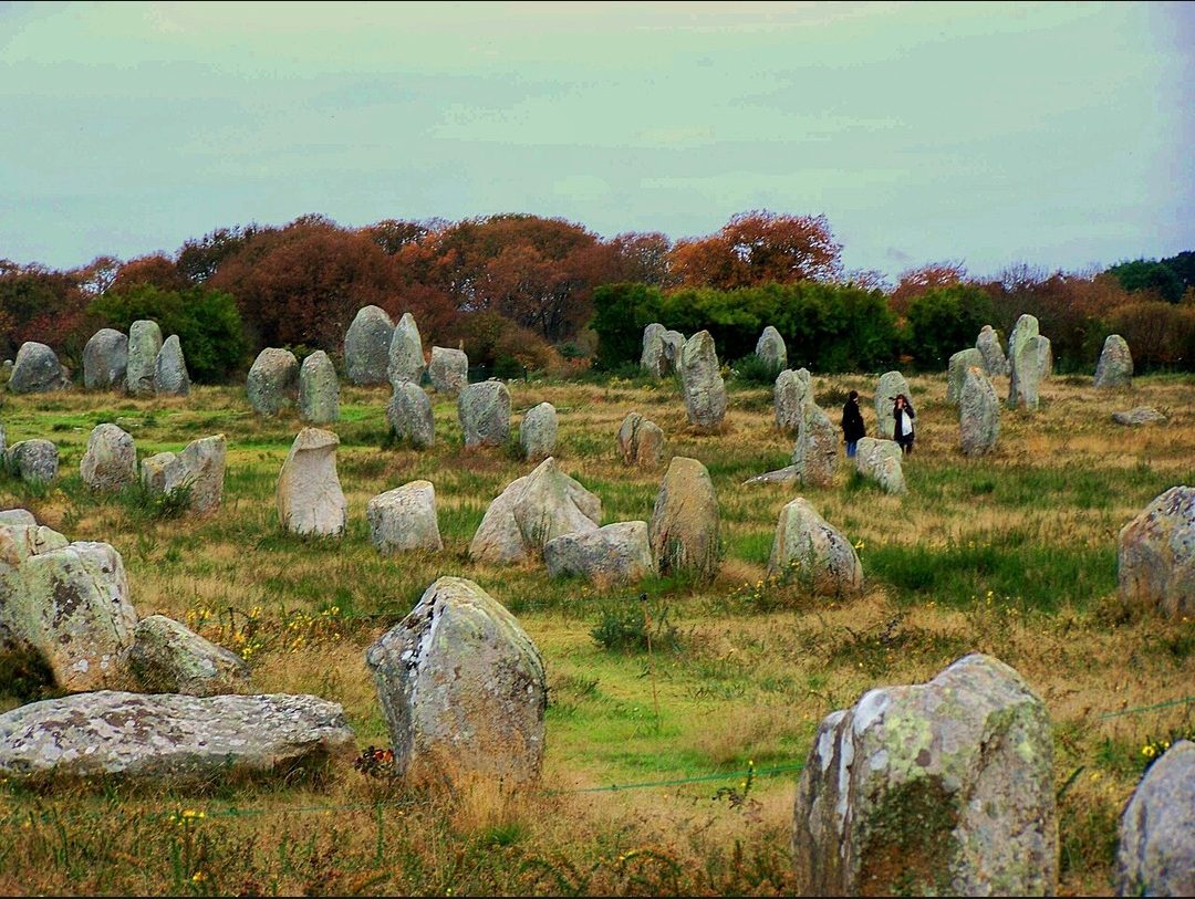
More than three thousand stones, laid out across ten kilometres
Carnac sits on the south coast of Brittany, in the Morbihan, and the rows named for it do not stop at the town boundary. Taken together with the smaller groups strung along the same line toward Erdeven, the alignments run for roughly ten kilometres and include more than three thousand standing stones — among the largest concentrations of megaliths anywhere in the world.
The three best-known groups sit in sequence. Ménec, the most intact, runs eleven parallel rows for more than a kilometre and finishes at its western end in a cromlech — a free-standing ring of stones — with a few blocks reaching about four metres tall. Kermario continues the line, its columns anchored at one end by a chambered dolmen some twenty-five metres across; aerial surveys over the group have also picked out a stone circle that is not obvious to anyone standing on the ground. Kerlescan, the third group, centres on a roughly 240-by-200-metre enclosure that is the best preserved of the stone rings along the whole route. A fourth, much smaller group, Petit-Ménec, lies further out, just over the boundary into La Trinité-sur-Mer.
None of it is a single, planned monument raised at once. It is centuries, probably many centuries, of a landscape being built onto — and that is itself part of why dating it has been so hard.
The burial mounds around the rows held axes that were never local
The alignments are not the only prehistoric structures in the area. The same stretch of coast holds several enormous burial mounds, and when nineteenth-century excavators opened them, what came out did not match what was lying around on the ground.
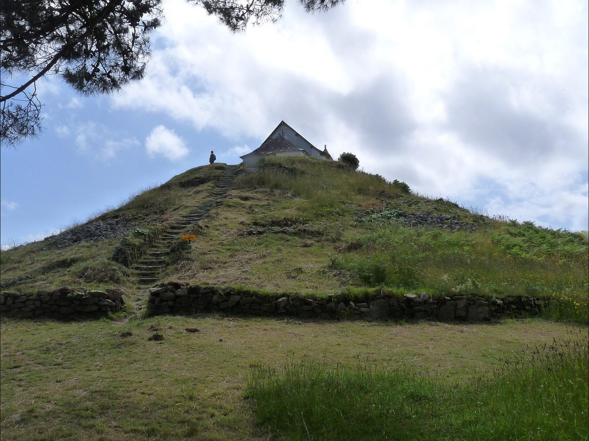
The Tumulus Saint-Michel, in the middle of Carnac itself, is about 125 metres long, 58 metres wide and 10 metres high — one of three giant mounds in the area, alongside Tumiac and Mané-er-Hroëk at Locmariaquer. René Galles, of the Morbihan Polymathic Society, opened its first stone-lined grave in 1862 and found beads and polished axes inside; Zacharie Le Rouzic excavated further sections in the early twentieth century and confirmed there was more structure buried beneath. A chapel was later built on the mound’s summit and has been rebuilt more than once since.
At Mané-er-Hroëk, Galles dug again the following year, funded by the regional préfet, and found a stone stele carved with axe and shield motifs sealing the burial chamber, along with grave goods substantial enough to be exhibited at the 1867 Paris Universal Exposition. Researchers have since shown that many of the polished axes recovered from tombs across this stretch of Brittany are jadeitite — a stone that does not occur naturally in Brittany at all. Its nearest known source is the Italian Alps, several hundred miles away. Whoever filled these mounds was burying objects that had travelled a very long distance to get there.
For two centuries, nobody could date a single stone
Granite carries no date of its own. The acidic soil across this part of Brittany also destroys bone almost completely, which strips tombs of the one material radiocarbon dating handles most reliably. And a standing stone, by definition, sits in a pit that was dug and refilled thousands of years ago — there is nothing in that act itself for a chemist to measure.
Some of the burial mounds could be dated earlier, because cremated or buried material inside them occasionally survived: Tumiac has been placed in the late fifth millennium BC by radiocarbon, and Mané-er-Hroëk is thought to be older still. But a tomb is not a row of standing stones, and for roughly two hundred years the alignments themselves floated across estimates spanning well over a thousand years, from the early Neolithic to the Bronze Age, depending on who was arguing.
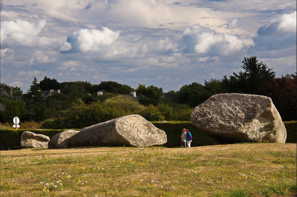
A 2025 rescue dig finally dated the rows — and found something it can’t explain
The breakthrough came almost by accident. A planned 7,000-square-metre business park at a site called Le Plasker, in Plouharnel, right beside the known alignments, triggered a mandatory rescue excavation. The dig, run by the firm Archéodunum under Audrey Blanchard with Bettina Schulz Paulsson of the University of Gothenburg leading the dating programme, recovered close to fifty radiocarbon samples and ran them through Bayesian statistical modelling — a technique that builds a far tighter chronology out of a large set of imprecise dates than any single sample could give on its own. The result, published in the journal Antiquity, placed several of the Carnac alignments at 4600 to 4300 cal BC and named the Bay of Morbihan the earliest megalithic region in Europe.
The same excavation turned up a detail nobody had been looking for. At Le Plasker the stones themselves are long gone, but the pits they once stood in survive, and those pits line up alongside a row of hearths and cooking pits — fire, set beside the stone sockets, repeatedly, along the length of the row. The excavators have said plainly that they cannot yet tell whether the fires mark cooking for a work crew, feasting tied to raising the stones, or something closer to ritual. Sediment analysis on the site is still running. A separate find nearby complicated the picture further: a monumental tomb built around 4700 BC sitting directly on top of the remains of a Mesolithic hunter-gatherer’s hut — not beside it, on it, at the exact seam between a hunting way of life and a farming one.
Two hundred years of confident, contradictory answers
Long before anyone had a date to work with, Carnac already had theories, and they came thick and fast. In 1796 the antiquarian La Tour d’Auvergne argued the rows were built for Druid assemblies. In 1805 Maudet de Penhoët argued they mapped the stars. In 1887 de Cleuziou tied them to the solstice sunsets that the main rows, running roughly east to west, do appear to track. Local tradition supplied its own answer rather than wait for the scholars: that the rows are a Roman legion turned to stone, in one telling by Merlin, in a Christian retelling by the sheer will of Pope Cornelius.

The most ambitious modern theory came from Alexander Thom, a professor of engineering at Oxford, who surveyed the alignments with his son in the early 1970s and argued that the stones encoded deliberate astronomical sightlines built on a single standard unit of measurement he called the megalithic yard. It was an elegant idea and it did not hold up well under testing. When other researchers checked the claim statistically against clean, well-preserved stone circles elsewhere in Britain, the results came back — in the words of one 1984 peer-reviewed re-analysis — equivocal at best: the pattern Thom thought he had found was not clearly there.
There is a simpler problem sitting underneath every geometric reading of Carnac, though, and it has nothing to do with statistics. The alignments have been quarried for building stone, cleared for farmland, and partly re-erected by people who did not record which stone had stood in which hole. Any survey of Carnac today is a survey of a monument that has already been rearranged.
The stones have been nearly as hard to keep as they have been to date
James Miln, the Scottish antiquarian who ran the first serious excavations at Carnac in the 1860s, worked the area around Kermario and left behind a collection that, after his death in 1881, became the founding gift of Carnac’s own prehistory museum. He trained a local assistant, Zacharie Le Rouzic, who went on to direct that museum for over fifty years, excavate the Tumulus Saint-Michel, and spend decades re-erecting menhirs that had fallen or been dragged off for field walls and farm buildings — marking each restored stone with a dot of red cement so later researchers would know it had been moved.
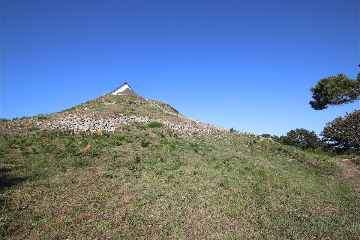
That tension between preservation and loss has not gone away. In June 2023, thirty-nine menhirs standing just outside the protected perimeter at Carnac were bulldozed, with official sign-off, to clear ground for a home-improvement store — a decision that drew an investigation from the local prosecutor’s office and made international news. Two years later, in July 2025, the surviving landscape was inscribed by UNESCO. Six thousand years upright, and whether a given stone survived to see that inscription came down, in the end, to which side of a property line it happened to stand on.
The site is still getting bigger
As recently as August 2026, a geophysical survey led by Guillaume Bruniaux of the consultancy ArchéoSolution, covering roughly two and a half hectares around the known alignments, located buried standing stones in short rows outside the previously mapped area, along with additional burial mounds and cooking-pit features — all without anyone putting a shovel in the ground. Published in the journal Archaeological Prospection, the survey’s plain conclusion is that the monument is larger than anyone had charted. It does not say what any of it was for. Nothing yet does.
Watch the full history
The video version walks the four alignments, the dating problem, and the 2025 dig in just under nine minutes.

Related reading
- The Kecksburg NASA Files Nobody Can Find
- Who Invented the Electric Toaster, Really?
- Why the Dorabella Cipher Remains Unsolved
- The History of the Vinaigrette Box: A Georgian Cure for Bad Air
Works cited
- Schulz Paulsson, Bettina, Audrey Blanchard, et al. “Le Plasker in Plouharnel: A Newly Discovered Section of the Megalithic Complex of Carnac, Dated to the Fifth Millennium cal BC.” Antiquity (2025). Link.
- University of Gothenburg. “New Light on the Stone Alignments in the Carnac Region.” News release, 25 June 2025. Link.
- Ministère de la Culture (France). “Astonishing Heaps of Stones.” Mégalithes, archeologie.culture.gouv.fr. Link.
- UNESCO World Heritage Centre. “Megaliths of Carnac and of the Shores of Morbihan.” World Heritage List, entry 1725.
- France Today Editors. “Carnac’s Megalithic Site Joins UNESCO World Heritage List.” France Today, 1 September 2025. Link.
- Cartwright, Mark. “Carnac.” World History Encyclopedia, 4 August 2014.
- Barnatt, John, and Gordon Moir. “Stone Circles and Megalithic Mathematics.” Proceedings of the Prehistoric Society 50 (1984): 197–216. Link.
- “Tumulus Saint-Michel, Carnac.” Association Grands Sites Mégalithiques du Morbihan. Link.
- “Tumulus de Mané-er-Hroëk, Locmariaquer.” Association Grands Sites Mégalithiques du Morbihan. Link.
- Cassen, Serge, Christine Boujot, Michel Errera, et al. “Green Treasures from the Magic Mountains: Alpine Jade Axes in the Tombs of the Gulf of Morbihan.” Antiquity Project Gallery. Link.
- Shaw, Garry. “Newly Discovered Standing Stones in France Shed Light on the Ancient Megalith-Builders.” The Art Newspaper, 12 August 2026. Link.
- “Carnac Standing Stones Destroyed to Make Way for DIY Store.” artnet News, June 2023.
So the dates are finally good. The scale is measured. What has never been measured, because there is nothing left to measure it with, is intent. No burial lies inside the alignments themselves. No writing survives anywhere near them to ask. The one dwelling found underneath a tomb at Le Plasker is older than the monument built on top of it, and the fires found beside the empty stone sockets there could be the record of a work crew’s lunch or of something considerably stranger — and the archaeologists who found them say they genuinely do not yet know which.
That is a strange thing for a monument this large, this visited, and this recently placed on a UNESCO list to still be true of. Most ancient sites of this scale get explained eventually, even if the explanation is argued over for a generation. Carnac has had explanations offered for it since before the French Revolution, and every one of them has failed to survive contact with better evidence. What is left, now that the dates are finally solid, is a line of empty stone sockets with fires burned beside them.
What were three thousand stones for?