
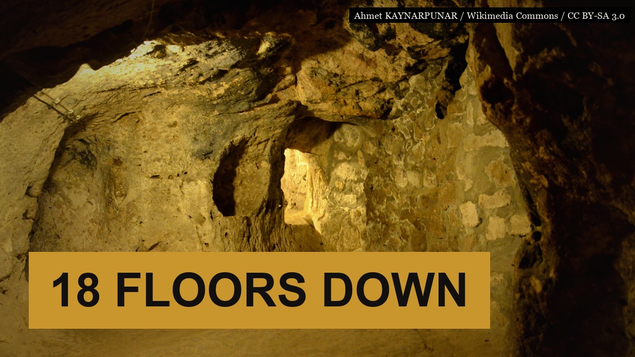
In 2013, two Turkish engineers ran Derinkuyu, the underground city cut into volcanic rock in central Turkey, through the same stress tests used on modern road tunnels, to see whether its ancient air, water and defensive systems had actually worked as well as everyone assumed. Ömer Aydan and Reşat Ulusay had been monitoring the rock since 1996, tracking how it moves, breathes and holds weight across two of Derinkuyu’s many levels. Publishing in the journal Rock Mechanics and Rock Engineering in 2013, they concluded that the underground city’s layout meets the standards modern engineers use to design tunnels today. Whoever shaped this rock understood exactly what it would carry.
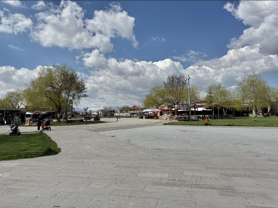
That is the one part of Derinkuyu that is not actually in dispute. The underground city beneath the Turkish town of the same name, in Cappadocia’s Nevşehir province, is a genuine engineered structure, lived in hard for centuries, and sound enough that it needed no reinforcement to survive into the twenty-first. What is unsettled is almost everything else: who began cutting it, how its residents managed air, water and defense across more than a dozen floors at once, and how a town of twenty thousand people came to lose track of a city sitting directly beneath its own streets. Working through those three questions, and being honest about which ones archaeology can actually answer, is more interesting than the bare claim that nobody knows.
The Rock Made Derinkuyu Possible, and the Geology Is Not in Question
Cappadocia sits on a thick bed of volcanic tuff, laid down by Erciyes and the region’s other now-extinct volcanoes over several million years. Tuff is compacted volcanic ash: soft enough to carve with hand tools while fresh, and it stiffens on exposure to air, so a chamber cut into it tends to hold its own ceiling up without added supports. The same rock stands exposed above ground across the region, in the well-known cut churches, dovecotes and fairy-chimney houses of Cappadocia, which is why the geology itself has never been the mystery here.
What is harder to pin down is the exact scale of what was cut. Eighteen levels is the figure that recurs most often in print, with roughly eight open to visitors; published depth estimates for the lowest level range anywhere from about sixty to eighty-five metres, and that spread has never been closed by one comprehensive public survey. Aydan and Ulusay’s fieldwork, running from 1996 and continuing past their 2013 paper, instrumented the fifth and seventh floors specifically, installing sensors for temperature, moisture, acoustic emission and electrical potential to track how the surrounding rock was actually behaving under load, rather than simply trusting how deep the published maps said it went.
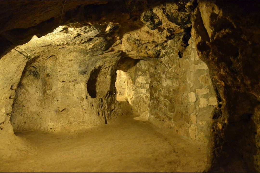
Their conclusion was not that Derinkuyu is some kind of structural miracle. It was that the room-and-pillar geometry — chambers left standing between excavated spaces, rather than open halls cut wall to wall — distributes the load the way a competently engineered modern underground structure would. The achievement is not that the rock is magic. It is that whoever planned the excavation, whenever that was, got the structural logic right from the first cut, in a material that punishes a wrong guess with a collapsed ceiling.
How Derinkuyu’s Air and Water Systems Actually Worked
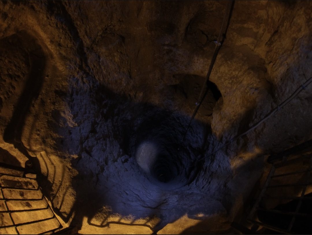
A hole eighty metres deep, cut for people to live in rather than simply pass through, has one obvious problem before it has any other: air. Derinkuyu’s answer is a main shaft, commonly given as roughly three by two point eight metres, that runs down through most of the inhabited levels and functions as the building’s lungs. Side chambers open off that shaft at staggered, offset points rather than stacking directly on top of one another, which keeps a column of air moving through the complex by convection instead of letting it stagnate in a dead pocket.
More than fifty secondary ventilation shafts have been counted feeding into that system, though the figure deserves some caution: far larger numbers circulate in popular accounts, some running into the thousands, and they read as repetition rather than as survey data. A credible count has simply never been published alongside a methodology, which says something about how much of what gets repeated about this site has never actually been checked.
Water took a separate, and in places deliberately separate, route. Wells served both the surface town and the levels below, including one commonly reported at around fifty-five metres. Not every well shaft connects straight through to ground level, and that looks like a design decision rather than an accident: an army besieging the town above could not poison a water source it could not physically locate from the surface. Getting breathable air and drinkable water to work at this depth, for an extended stay, is not something a community backs into by chance. It is planned infrastructure, built long before anyone had instruments to measure whether it was working.
The Building Was Designed to Be Surrendered One Floor at a Time
Every defensive feature inside Derinkuyu assumes the same thing: that an enemy might eventually get past the entrance. The corridors connecting levels are narrow and low enough to force anyone moving through them into single file, bent forward, usually in the dark — a chokepoint a handful of defenders could hold against a far larger force simply by standing at the far end of it.
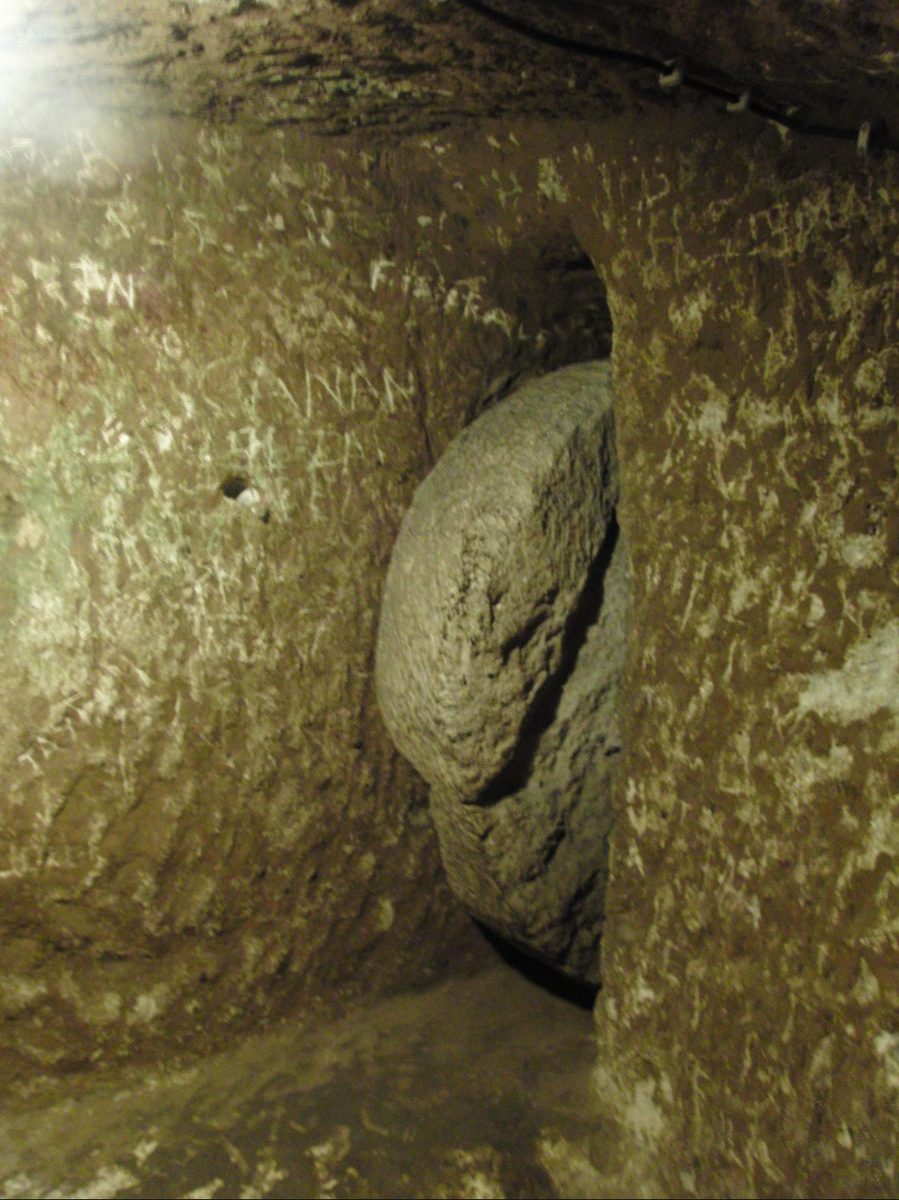
At several of those chokepoints sit the structure’s signature feature: circular stone doors, reported at half a tonne or more, set into slots cut to the exact curve of the disc so they roll across the passage like a wheel instead of needing to be lifted. Each has a socket cut into one face for a wooden bar, and nothing on the other — meaning the door can only be operated from inside the level it protects. An attacker who broke through one door found not a hallway but another sealed floor, with its own independent closure. The design does not assume the city will never be breached. It assumes that it eventually will be, and plans for losing it one level at a time rather than all at once, which has more in common with how a besieged storm cellar is built than with how a palace is.
Kaymakli, a separate underground settlement nine kilometres away, has an identical rolling-door mechanism, labelled as such on its own site signage — good evidence that this was a known regional solution rather than a one-off invention at Derinkuyu alone. The frequently repeated claim that a tunnel several kilometres long physically connects the two sites is different in kind: it is a belief some archaeologists hold and that visitors are often told, not a connection anyone has surveyed and published. Both claims get repeated with the same confidence. Only one of them has evidence behind it.
What the Written Record Actually Says, and From How Far Away
The oldest description of this building technique does not mention Derinkuyu at all. Writing around 370 BC in the Anabasis, Xenophon described houses far to the east, in Armenia, that were entered through an opening like a well mouth but opened out into spacious rooms below; livestock went down earthen ramps cut for the purpose while people used ladders, and inside were stores of wheat, barley, beans and barley wine. It is the earliest surviving account of the method Cappadocia would later apply at a vastly larger scale — not a description of this specific site, and not proof of when Cappadocians began using it themselves.
What can be dated with real confidence at Derinkuyu is Byzantine and later. Cross-shaped chapels, Greek inscriptions, and the architectural details of the lower levels fit the pattern the art historian Lyn Rodley documented across Cappadocia’s Christian cave sites in her 1985 survey for Cambridge University Press: communities expanding and consecrating space that was already there, most plausibly during the centuries of Arab-Byzantine conflict between roughly 780 and 1180. The Greek-speaking population above ground had a word for refuges like this, katafygia, and it was not an antiquarian term. The Cambridge philologist R. M. Dawkins, working in central Anatolia between 1909 and 1911, recorded villagers from the town of Axos sheltering underground during the violence of that year and published the testimony in his 1916 study of the region’s Greek dialects — within living memory of people who were still using these spaces exactly as intended.
Three Candidates for the First Cut, and Why the Case Keeps Going Cold
Byzantine use explains the chapels. It does not explain the eighteen levels those chapels sit inside, and this is where the record runs out. Three positions circulate for who began the excavation, and none of them rests on a find actually recovered from inside Derinkuyu itself.
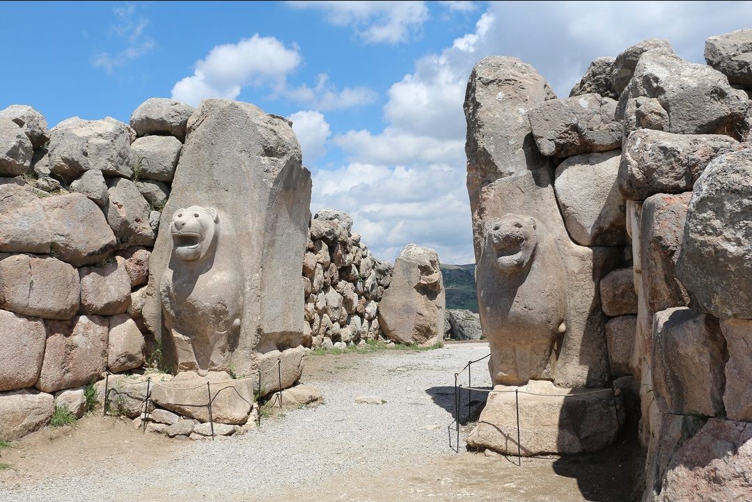
The first credits the Hittites, the dominant power across central Anatolia from roughly 1600 to 1200 BC, on the reasoning that only a state with that kind of organisation could have launched a project this size — a civilisation whose own disappearance is its own unresolved archaeological argument. The case is entirely circumstantial: no inscription, no pottery assemblage, no identifiable Hittite tool type has ever been excavated from within the complex.
The second, and the one most often printed on signage and in general references, credits the Phrygians, in the eighth or seventh century BC. It is also the hedgiest of the three: nearly every source that states it adds “may have” or “is thought to have,” a pattern of qualification that itself suggests inherited assumption rather than an independent finding.
The third position is the least dramatic and the hardest to argue against: that the only honestly dateable material at Derinkuyu is Byzantine, and that everything earlier is an inference from the technique rather than a recovered fact. The dispute cannot be settled for a structural reason, not just a lack of effort. Derinkuyu was subtracted, not built — there are no foundation trenches, no mortar joints, no construction fill, nothing organic sealed into a wall to carbon date. Every later occupant re-cut, re-plastered and re-used the chamber the previous one left, erasing whatever evidence of the earliest phase might otherwise have survived. A site that keeps disappearing into its own later renovations is, by its nature, a cold case rather than a solvable one — closer in kind to a cipher nobody has broken than to a crime nobody has investigated.
How a Town Loses an Entire City Underneath It in Forty Years
Derinkuyu did not stay hidden because it was forgotten in antiquity. It went out of use far more recently than that, and the reason has nothing mysterious about it. Under the 1923 convention exchanging populations between Greece and Turkey, the Greek Orthodox communities of Cappadocia — overwhelmingly Turkish-speaking Karamanlides, and by the Duke University librarian Sean Swanick’s account one of the largest single groups moved in the entire exchange — were relocated to Greece, many resettling in villages they named after the homes they had left behind. The households who knew which cellar wall hid a passage, and which rolling door opened from which side, left with them. Within roughly forty years, the practical knowledge of the refuge system had emigrated along with the people who held it, and the passages were simply sealed behind ordinary cellar walls again — until 1963, when a Derinkuyu resident doing renovation work broke back through to one.
The region has kept producing the same problem since. In 2014, a government housing-renewal project demolishing older buildings around the Nevşehir fortress, a few kilometres from Derinkuyu, broke into a separate complex entirely, one a geophysical survey of the surrounding area suggested could extend past 450,000 square metres at depths over a hundred metres, according to reporting in the Hürriyet Daily News. It is still being excavated and has no peer-reviewed publication of its own yet. And in May 2025, the acoustics researcher Sezin Nas presented a digital reconstruction of Derinkuyu’s own soundscape to a joint meeting of the Acoustical Society of America, modelling how the shafts likely carried voice as well as air between floors — a reminder that even a site this thoroughly mapped keeps yielding new, checkable questions.
Watch the full history
The video version walks the same corridors in under ten minutes, from the 1963 discovery to the stone doors to the dating dispute that still has not been settled.

Everything about Derinkuyu that can be dated with confidence belongs to people defending and furnishing a space someone else had already dug: Byzantine villagers cutting a chapel into a floor that was already there, refugees in 1909 sheltering in corridors first opened centuries earlier, a Derinkuyu family in 1963 rediscovering a passage their own neighbours had simply stopped mentioning. The site’s defining fact is not that it is unexplained. It is that almost everyone who has ever used it inherited it from someone whose name did not survive the handover.
That is also why the mystery keeps renewing itself instead of resolving. A government survey a few kilometres away can turn up an even larger complex with the identical problem attached, and an acoustics lab can still find something nobody has modelled before, in a space people have been walking through for more than half a century of tourism. The town above ground answers to a name and a sign at its edge. Whatever is cut into the rock below it never has.
Related reading
- Why Was Göbekli Tepe Buried? What the Evidence Actually Shows
- What Caused the Bronze Age Collapse?
- The Mystery of the Beale Ciphers, Explained
- The Storm Cellar Existed Before Tornado Warnings Did
Works cited
- Aydan, Ömer, and Reşat Ulusay. “Geomechanical Evaluation of Derinkuyu Antique Underground City and Its Implications in Geoengineering.” Rock Mechanics and Rock Engineering 46, no. 4 (2013): 731–754. Link.
- Xenophon. Anabasis, 4.5.25–27. Translated by Carleton L. Brownson. Loeb Classical Library. Harvard University Press, 1922 (rev. ed.).
- Rodley, Lyn. Cave Monasteries of Byzantine Cappadocia. Cambridge University Press, 1985.
- Dawkins, R. M., and W. R. Halliday. Modern Greek in Asia Minor: A Study of the Dialects of Sílli, Cappadocia and Phárasa. Cambridge University Press, 1916. Link.
- UNESCO World Heritage Centre. “Göreme National Park and the Rock Sites of Cappadocia.” World Heritage List, No. 357.
- Swanick, Sean. “Cappadocia and the 1923 Population Exchange/Mübadele/Ανταλλαγή.” Duke University Libraries Blogs, March 21, 2025. Link.
- “Underground City Comes to Surface.” Hürriyet Daily News, February 15, 2016. Link.
- “Re-Creating the Sounds of an Underground City.” Acoustical Society of America, 188th Meeting, May 21, 2025. Link.