
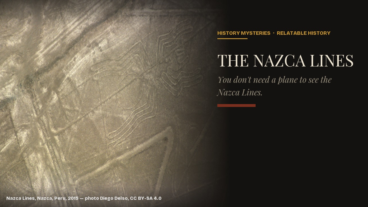
In 2024, a team of archaeologists working with an AI image-recognition system spent six months walking a stretch of Peruvian desert that had already been surveyed, on and off, for nearly a hundred years. They came back with 303 previously unknown geoglyphs — figures etched into the ground — almost doubling the number anyone had ever catalogued there. The region had not grown any new lines in the meantime. People had simply been looking at the wrong scale.
That discovery is as good a way as any into the actual state of the Nazca Lines, a few hundred miles south of Lima: not a solved mystery dressed up for television, and not quite the blank unknown the question-mark headlines imply either. There is a real, if incomplete, body of evidence for why the Nazca Lines were made, when, and by whom — a record left on the ground by a culture that, much like — a continent and an ocean away — the undeciphered Linear A script, kept no written account of its own reasoning.
Several competing explanations have each gathered genuine evidence without managing to rule the others out, and the newest research is reshaping even that picture.
A Desert Archaeologist Found Them on Foot, Not From a Plane
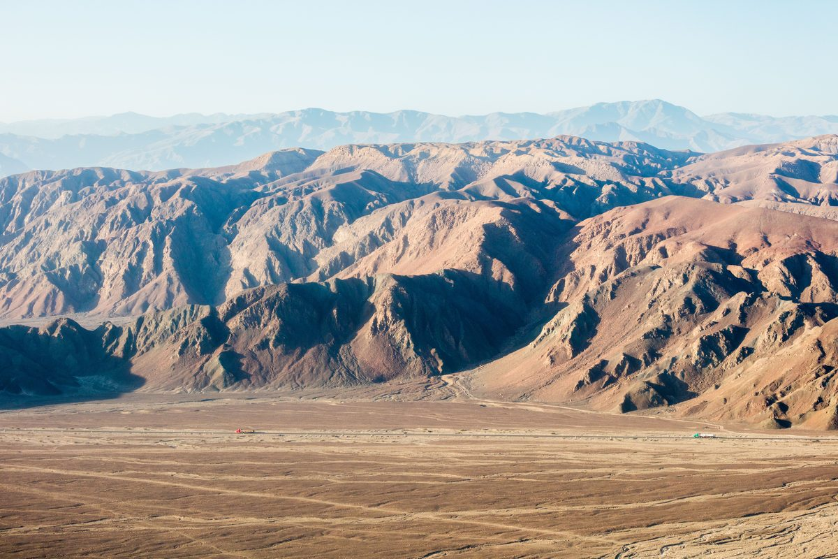
The usual version of the discovery story puts an airplane in it, which has the order backwards. The Peruvian archaeologist Toribio Mejía Xesspe came across the lines in 1927 while walking through the foothills above the Nazca pampa on an unrelated survey, and described what he found as sacred pathways. He presented the find to the Peruvian Geographical Society in 1939, by which point commercial flights had begun crossing the region and passengers had separately started noticing shapes in the ground below.
The connection most people now know — an American researcher and a German-born mathematician mapping the lines from above — came after Mejía Xesspe’s find, not before it. Paul Kosok, a historian from Long Island University researching ancient irrigation in Peru, is usually credited with recognizing a solar alignment in one of the lines at sunset during the Peruvian summer of December 1941, which led him to call the pampa “the largest astronomy book in the world.” Maria Reiche, who had been working as his translator and assistant, took over the line of research and did not put it down again; it occupied most of the rest of her life.
Reiche’s own method was almost embarrassingly low-tech for a site this well known: she walked the pampa with a ladder and a household broom, climbing for a wider view of a figure and sweeping windblown sand off the exposed ground to make a line’s edge legible again. Over nearly sixty years she produced the first systematic maps of the site, catalogued dozens of figures, and successfully lobbied Peru’s government to restrict vehicle access and fund the roadside viewing tower that still lets visitors see several figures without a plane. The foot discovery in 1927 and the aerial mapping that followed are two different projects that most retellings compress into one.
Removing Stone Is the Entire Technology
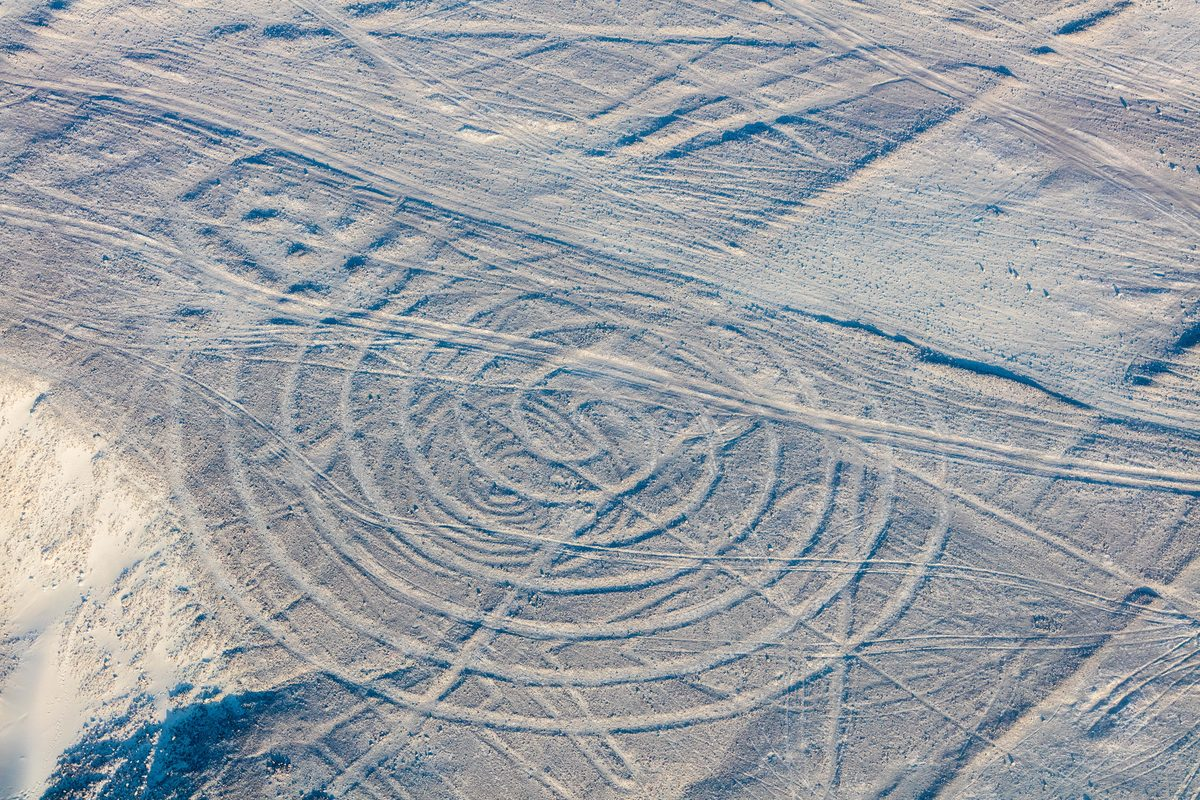
However the figures were found afterward, making one required almost no equipment. The Nazca pampa is covered in a layer of reddish-brown stones darkened over millennia by desert varnish, a thin crust of iron and manganese oxide that forms on exposed rock in arid climates. Underneath that layer sits a much paler clay-and-gypsum subsoil. Lift the dark stones off a strip of ground and pile them along its edges, and the strip reads, from almost any distance or elevation, as a bright line against a dark field. That contrast, not any carving or digging, is the whole mechanism.
Making a straight line that holds for miles, or a spiral that closes on itself, or an animal whose proportions read correctly only from height, is a surveying problem rather than an engineering one, and the Nazca evidently solved it with stakes, cord, and sightlines rather than instruments. Archaeologists Helaine Silverman and Donald Proulx, whose synthesis of Nazca culture is still a standard academic reference, counted past eight hundred straight lines, around three hundred geometric figures, and roughly seventy biomorphic figures — animals, plants, and a few human forms — before the AI-assisted surveys of the 2020s added hundreds more to that last count.
What makes the lines durable rather than merely clever is the climate that let them sit for two thousand years instead of one rainy season. The region gets only minutes of measurable rainfall most years, has little wind strong enough to redistribute surface stone, and the desert varnish itself takes centuries to regenerate once disturbed. A line scuffed into almost any other landscape on Earth would have erased itself within a generation.
The Calendar Theory a Computer Test Could Not Confirm
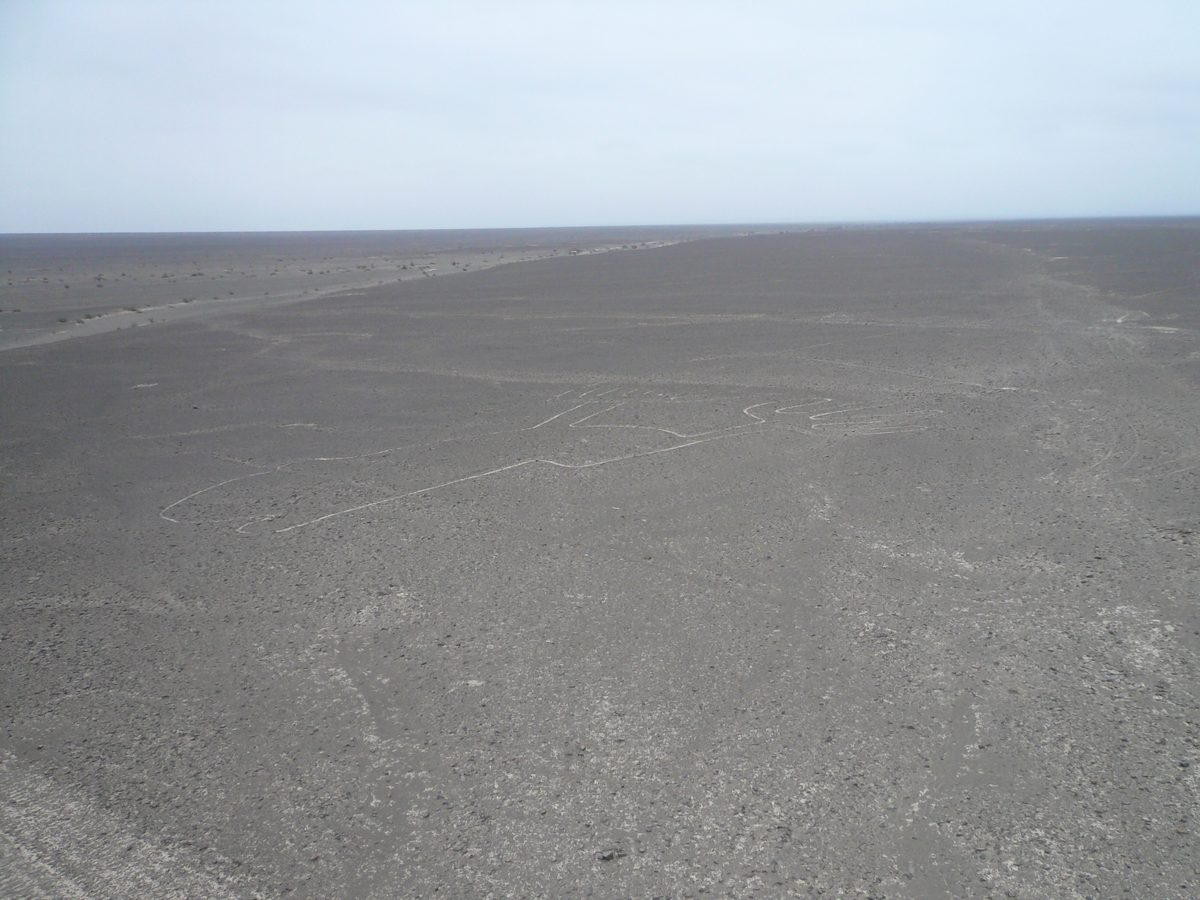
Kosok’s solstice sighting and Reiche’s decades of mapping were both built on one working idea: that the lines, individually or in combination, pointed at astronomically significant risings and settings — solstices, equinoxes, perhaps the positions of stars useful to a farming society that depended on a predictable planting calendar. Reiche spent a career compiling line orientations in support of it.
By the end of the 1960s, the astronomer Gerald Hawkins, who had already run a comparable statistical test against Stonehenge, pointed a computer at a sample of Nazca lines and checked their bearings against the full range of solar, lunar, and stellar events a culture without instruments could plausibly have tracked. His conclusion, reported at the time as close to a final word, was that the lines matched astronomical targets no more often than random lines drawn across the same desert would have matched them by chance.
That has not entirely settled the question. A 2021 re-examination in the peer-reviewed journal Applied Sciences makes the methodological case for why: Hawkins tested only a limited sample of lines within a small part of the full pampa, which its authors argue is too thin a slice of a site this large to rule out an astronomical function across the whole network. Their own reanalysis does not revive the Kosok–Reiche calendar theory wholesale, but it does conclude that Hawkins’s negative result, treated for fifty years as a closed case, was never actually comprehensive enough to be one. The honest state of the astronomical theory is neither confirmed nor killed.
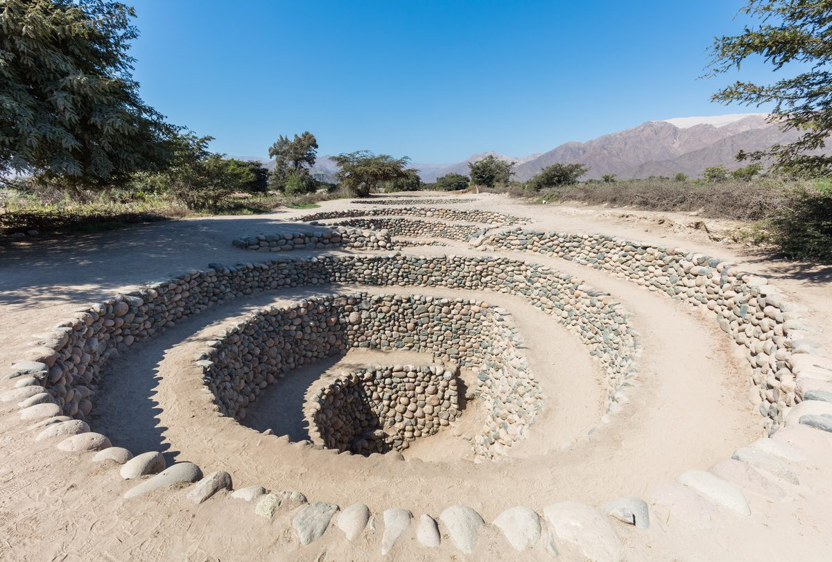
A Map of Water in a Place That Almost Never Gets Any
A different line of research set the astronomy aside and asked a more basic question: what would a farming settlement in one of the driest inhabited landscapes on the planet actually need marked on the ground? The hydrologist David Johnson spent years tracing the courses of Nazca lines against the region’s puquios — the underground filtration galleries the Nazca and their successors built to tap aquifers without losing water to evaporation — and, with archaeologists Donald Proulx and Stephen Mabee, published a 2002 study arguing that a meaningful share of the straight lines correlate with the location of these water sources and the geological faults that fed them.
Under that reading, at least part of the network functioned as something closer to infrastructure than ceremony: a durable, communally maintained record of where water could be found and how it moved underground, in a place where getting that wrong was a survival problem rather than a philosophical one. The theory has its own limits: it fits a subset of the straight and trapezoidal lines near known puquios well, but has much less to say about the animal figures, which rarely sit near documented water features at all. No single theory here explains the full catalogue, and the water-mapping idea reads as a strong partial answer rather than a complete one.
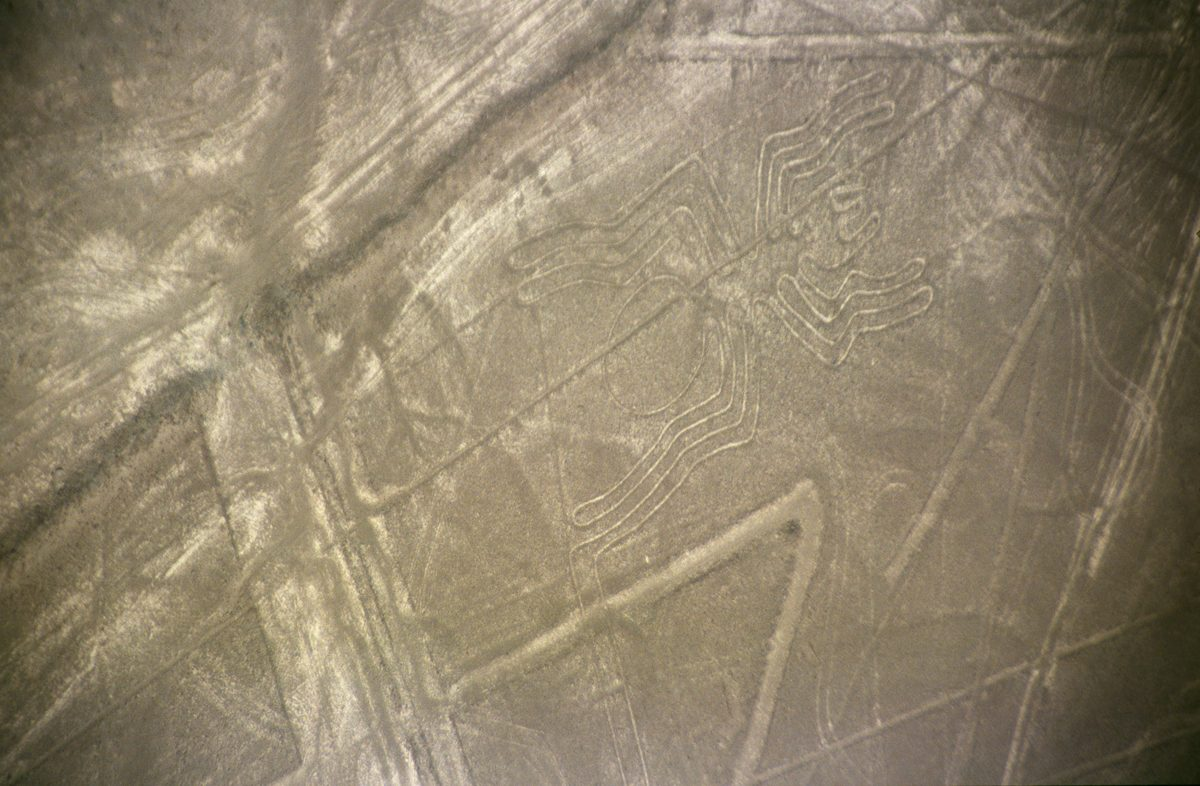
Lines Built to Be Walked, Not Viewed From Above
A third strand of research argues that the whole premise of viewing the lines from a distance gets the Nazca’s own relationship to them backwards. The anthropologist Johan Reinhard, drawing on his broader fieldwork on Andean mountain worship, proposed that many lines functioned as ceremonial paths connecting settlements to sacred peaks and water sources, walked in procession as part of rituals aimed at securing rain and agricultural fertility — a reading that fits a culture for whom particular mountains, not the sky, were the primary object of reverence.
Archaeologists Clive Ruggles and Nicholas Saunders pushed that ground-level argument further in a detailed 2012 study in the journal Antiquity, built from fieldwork tracing which geoglyphs were built in which order, and found them forming interconnected routes complex enough, in their phrase, to justify calling the whole network a labyrinth. Several of the best-known figures support this directly: a number of them are drawn as one continuous path that never crosses or re-touches itself, so that tracing the figure’s outline on foot and tracing its full shape are the same act. On this account the figures were never primarily meant to be looked at. They were meant to be walked, by people who already knew what shape their feet were tracing.
What AI Revealed About Why the Nazca Lines Were Made
The clearest recent evidence on the purpose question has come not from a new theory but from simply finding far more of the lines than anyone had before. In 2023, researchers from Yamagata University working with IBM Research Japan published a deep-learning system trained to spot geoglyph candidates in aerial imagery, built specifically to recognize partial and unfamiliar shapes rather than only the handful of known figure types; in its first substantial run it identified four previously undocumented geoglyphs — a humanoid figure, a pair of legs, a fish, and a bird — at roughly twenty-one times the speed of manual survey.
The team then scaled the method up, and in September 2024 published a much larger result in the Proceedings of the National Academy of Sciences: 303 new figurative geoglyphs identified in six months of AI-guided field survey, against the roughly 430 catalogued across nearly a century of prior work by Mejía Xesspe, Reiche, and everyone after them. That alone reframes the older debate — most theories about “the Nazca Lines” were built on fewer than half of the figures that actually exist, a gap not unlike the long-running argument over whether the Baghdad Battery was ever really a battery, where conclusions were also drawn from an incomplete picture of the find.
More useful than the count is where the AI survey found the new figures sitting. They split into two statistically distinct groups: smaller “relief-type” figures, overwhelmingly depicting humans or domesticated animals, cluster close to ancient footpaths — an average of around forty metres away — in a pattern the researchers read as meant to be seen by individuals or small groups actually walking those trails. Larger “line-type” figures, mostly depicting wild animals, instead cluster near the straight and trapezoidal line networks farther from any path, consistent with use in larger, community-scale ritual gatherings rather than passing foot traffic. The two kinds of figure may simply have had two different jobs, a split not unlike the debate over what Roman dodecahedra were actually for, where several plausible uses have turned out to coexist rather than compete — which would explain why no single theory devised to cover every Nazca figure has ever fully fit.
Watch the full history
The video version covers the discovery, the technique, and the failed calendar test in under a minute.

Related reading
- What Were Roman Dodecahedra Actually Used For?
- Was the Baghdad Battery Real? What the Evidence Actually Shows
- What Actually Happened to the Ark of the Covenant?
- Why Linear A Still Can’t Be Read
- How the Antikythera Mechanism Predicted Eclipses
Works cited
- Richter, Christiane, Bernd Teichert, and Karel Pavelka. “Astronomical Investigation to Verify the Calendar Theory of the Nasca Lines.” Applied Sciences 11, no. 4 (2021): 1637. Link.
- Sakai, Masato, Marcus Freitag, et al. “AI-Accelerated Nazca Survey Nearly Doubles the Number of Known Figurative Geoglyphs and Sheds Light on Their Purpose.” Proceedings of the National Academy of Sciences 121, no. 40 (2024): e2407652121. Link.
- Reinhard, Johan. The Nazca Lines: A New Perspective on Their Origin and Meaning. 4th ed. Lima: Editorial Los Pinos, 1988.
- Johnson, David W., Donald A. Proulx, and Stephen B. Mabee. “The Correlation Between Geoglyphs and Subterranean Water Resources in the Río Grande de Nazca Drainage.” In Andean Archaeology II, edited by Helaine Silverman and William H. Isbell, 307–332. Boston: Springer, 2002. Link.
- Ruggles, Clive, and Nicholas J. Saunders. “Desert Labyrinth: Lines, Landscape and Meaning at Nazca, Peru.” Antiquity 86, no. 334 (2012): 1126–1140.
- Silverman, Helaine, and Donald A. Proulx. The Nasca. Malden, MA: Blackwell Publishing, 2002. Link.
- Unkel, Ingmar, Markus Reindel, Hermann Gorbahn, Johny Isla Cuadrado, Bernd Kromer, and Volker Sossna. “A Comprehensive Numerical Chronology for the Pre-Columbian Cultures of the Palpa Valleys, South Coast of Peru.” Journal of Archaeological Science 39, no. 7 (2012): 2294–2303.
- UNESCO World Heritage Centre. “Lines and Geoglyphs of Nasca and Pampas de Jumana.”
- Yamagata University. “Results of Nasca Research Utilizing Deep Learning Technology Have Been Published in the International Academic Journal ‘Journal of Archaeological Science.’” Press release, June 1, 2023. Link.
- Cogorno Mendoza, Ana Maria. “The Nazca Lines: A Life’s Work.” World History Encyclopedia, June 4, 2019. Link.
- Eschner, Kat. “How a German Mathematician Took Responsibility for an Ancient Peruvian Artifact.” Smithsonian Magazine, May 15, 2017.