
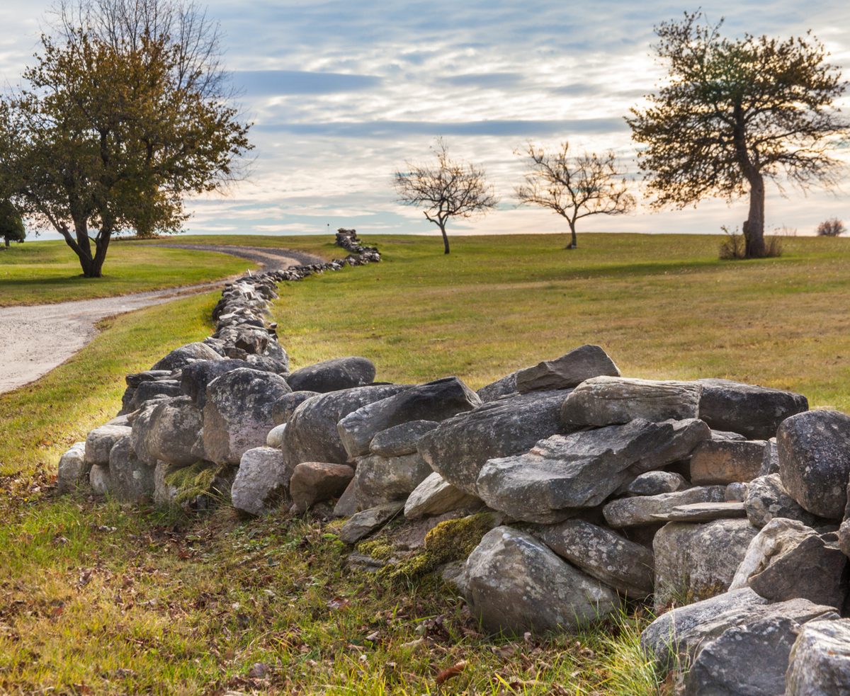
New England’s stone walls add up to roughly 240,000 miles — enough, laid end to end, to circle the Earth nearly ten times over. Almost none of that stone was quarried. Every piece of it came out of a field, a pasture, or a dooryard, pried loose by a farmer who needed it gone and had nowhere convenient to put it.
The walls were never really built in the way a mason builds a building. They were dumped, piece by piece, along the same fence lines, for roughly two centuries, until the dumping itself started to look like architecture. Most of that stone went down between 1750 and 1850, on farms that in many cases were abandoned within a hundred years of being cleared.
Why there was so much stone to begin with, why it kept coming back no matter how many times a field was cleared, and why most of it now stands quietly in second-growth forest rather than open pasture, comes down to a glacier, a run of cold centuries, and an economic collapse that emptied the New England countryside almost as fast as it had been settled.
A glacier left the stone behind fifteen thousand years before anyone needed it gone
The raw material predates the farms by a very long margin. As the Laurentide ice sheet made its final retreat across the region, roughly 20,000 to 15,000 years ago, it broke up the local bedrock and scattered the fragments across the land it had just uncovered. For most of the millennia that followed, that stone sat buried under a deepening blanket of forest soil, leaf litter, and moss, far enough down that it gave early colonial farmers little warning of what they were about to find.
Stone walls, as a landform, turn out to need a surprisingly specific overlap of conditions, which is why they are so distinctively a New England thing rather than an American one. They appear where hard, crystalline bedrock meets glacially deposited soil and a history of small family farms all working at once. Head south past Staten Island, into the softer sedimentary rock of the mid-Atlantic, and the walls largely stop. Head north into New England’s higher, less-farmed terrain, and they thin out again. The stone, the soil, and the settlement pattern all had to line up.
Clearing a field once did not mean the stone was gone for good
Converting forest to farmland stripped away the insulating layer that had kept the buried stone in place: the mulch, the duff, the root mat. Once that cover was gone, and especially during the colder stretch of the Little Ice Age that lasted in various forms from roughly 1300 to 1900, winter frost could reach much deeper into bare, tilled soil than it ever had under forest. Two explanations compete for how it then moves a stone: either the stone conducts cold faster than the soil around it, so ice forms underneath and acts like a jack, or the freezing soil grips the stone’s sides and drags it upward while loose soil flows into the gap left underneath, so it never settles back down to its old depth.
Either way, the effect on a working farm was the same: a field cleared of stone one year produced a fresh crop of it the next, pushed up from below by a process the farmer could not see happening and could not stop. Clearing a New England field was never a single job. It was a recurring one, repeated every spring for as long as the land stayed in tillage, which is part of why the walls kept growing years and sometimes decades after a field was first broken.
The cycle has not stopped. Gardeners in the region still pull a fresh crop of stones out of the same beds every spring, for the same reason their eighteenth-century predecessors did, and the standard advice for slowing it down — a thick layer of leaf or straw mulch over winter — is really just an attempt to put back the insulating duff that clearing the land removed in the first place.
Most of New England’s stone walls went up in the fifty years after the Revolution
The oldest documented attempt at permanent English settlement in the region dates to 1607, near the Kennebec River, but the wall-building boom came much later and moved fast once it started. A large share of New England’s stone wall accumulated between about 1750 and 1850, and construction peaked hardest in the fifty years between the start of the Revolution in 1775 and the opening of the Erie Canal in 1825, a period that also saw many older, cruder walls rebuilt into tidier, more deliberate ones, often by the wealthier farmers and early industrialists who could afford the labor.
Estimating how much wall all of that added up to has been attempted twice, eight decades apart, by two very different methods. In 1939, a mining engineer named Oliver Bowles, working from an 1871 agricultural census, put the figure for the northeastern United States at more than 259,000 miles, most of it in New England, and treated the walls as a standing reserve of building stone rather than a historical curiosity. More recently, twenty-first-century lidar mapping across New England’s roughly 40,000-square-mile heartland has arrived at a strikingly similar order of magnitude: about 240,000 miles, or close to six linear miles of wall for every square mile of land.
Moving the stone took a sledge, because a cart could not survive the ground
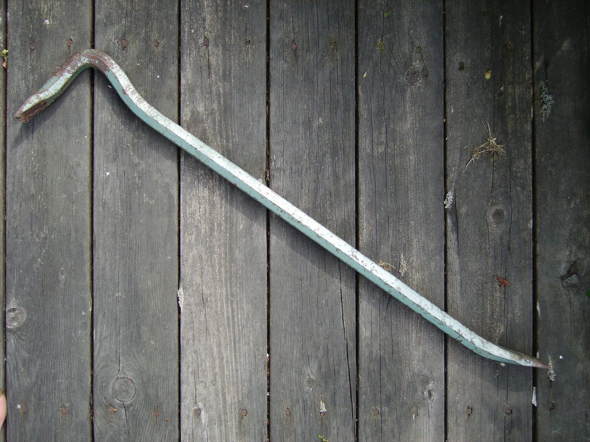
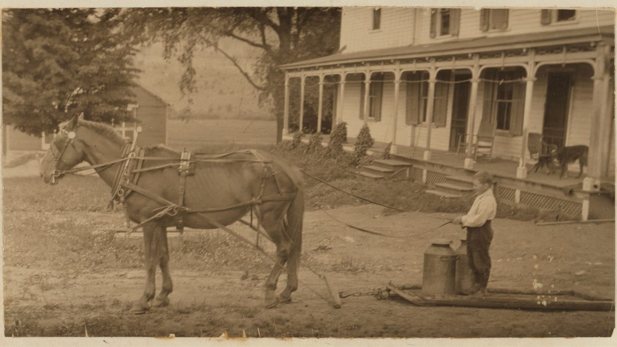
Once a stone was pried loose, usually with an iron bar, it still had to travel to the fence line, and a wheeled cart struggled badly on newly cleared, rock-studded ground. A flat wooden sledge dragged by an ox or horse had no wheels to catch on a buried root or snap an axle on a hidden ledge, which is why New England farmers favored sledges for the job for as long as fields needed clearing, and why the type was still being refined well into the industrial era: a patent for an improved “stone boat or drag,” with sheet-metal runners meant to outlast wood, was granted to Arthur M. Hussey in 1913.
What a farmer built with that hauled stone varied with how much of it there was. A single, or “thrown,” wall was one stone wide and three to four feet high, laid with some care but left rough-looking. A double wall used two such walls tied together every few feet by long stones spanning the gap between them. Where a field had produced far more stone than a boundary wall could reasonably hold, farmers built wide “disposal” walls, two faces set three to twelve feet apart with the surplus simply dumped into the gap, built mainly to get rid of stone rather than to look like anything in particular. One documented account describes a double wall roughly five feet wide and five feet tall, built entirely from stone cleared off a single four-and-a-half-acre pasture. Smaller stones were not wasted either: infill rubble, usually under a foot long, was packed into the gaps between the larger stones to keep a wall from racking apart. The best-laid examples, with stone quarried and hammered to fit, were usually the work of hired craftsmen; the rougher, more common walls were built by the farm families themselves, along with wage laborers, enslaved people, and prisoners, depending on the farm and the decade.
The region gave up on farming almost as fast as it had cleared the land
Upland New England farming stayed profitable into the 1830s, which is part of why so many walls from that period were rebuilt rather than simply piled. After that, its fortunes turned quickly. The Erie Canal, opened in 1825, put New England’s stony, thin-soiled hill farms into direct competition with the flat, stone-free farmland of the Midwest, while new mill towns and early railroads offered steadier wages than another season of pulling rock out of the ground. Land values on the stoniest upland farms fell with them. By the 1880s, thousands of rural farms, especially in the uplands furthest from the growing cities, had simply been abandoned.
Some of that stone went on to a second career. Walls on abandoned farms were quarried for bridge abutments, canal works, piers, and road base. On farms that stayed working, walls were often torn down anyway, to enlarge a field or improve drainage, since a boundary built to dispose of stone had no particular reason to survive once the fields on either side of it were combined.
The forest grew back around what was left, and lidar just found it again
Over the twentieth century, second-growth forest reclaimed most of the abandoned upland farmland, and the walls that had marked its fields went with it, standing but no longer tended. The wooden rails that once topped many of them rotted away first. The stone itself came apart more slowly, and not mainly from frost, despite what is still the popular explanation: Robert Frost, who farmed roughly thirty acres in Derry, New Hampshire, from 1900 to 1909 and drew his 1914 poem “Mending Wall” from the walls on that property, blamed frost heave and hunters for the gaps he found every spring. Geologist Robert Thorson, who has studied the region’s walls as closely as anyone, argues the bigger culprit historically was vegetation: vines, brambles, and falling trees working stones loose over decades, a process climate change now appears to be speeding up.
What survived did not disappear from the landscape so much as it disappeared from view, swallowed by trees that in many stretches have now stood for a century or more. Twenty-first-century lidar surveys, which can strip forest canopy out of an elevation map entirely, have revealed what amounts to a nearly unbroken network of walls running through New England woods that most people walking through would never notice. The walls also turned out to matter ecologically where they stand: they divide second-growth forest into distinct patches, and their stone surfaces host lichen and moss communities found almost nowhere else except on exposed bedrock.
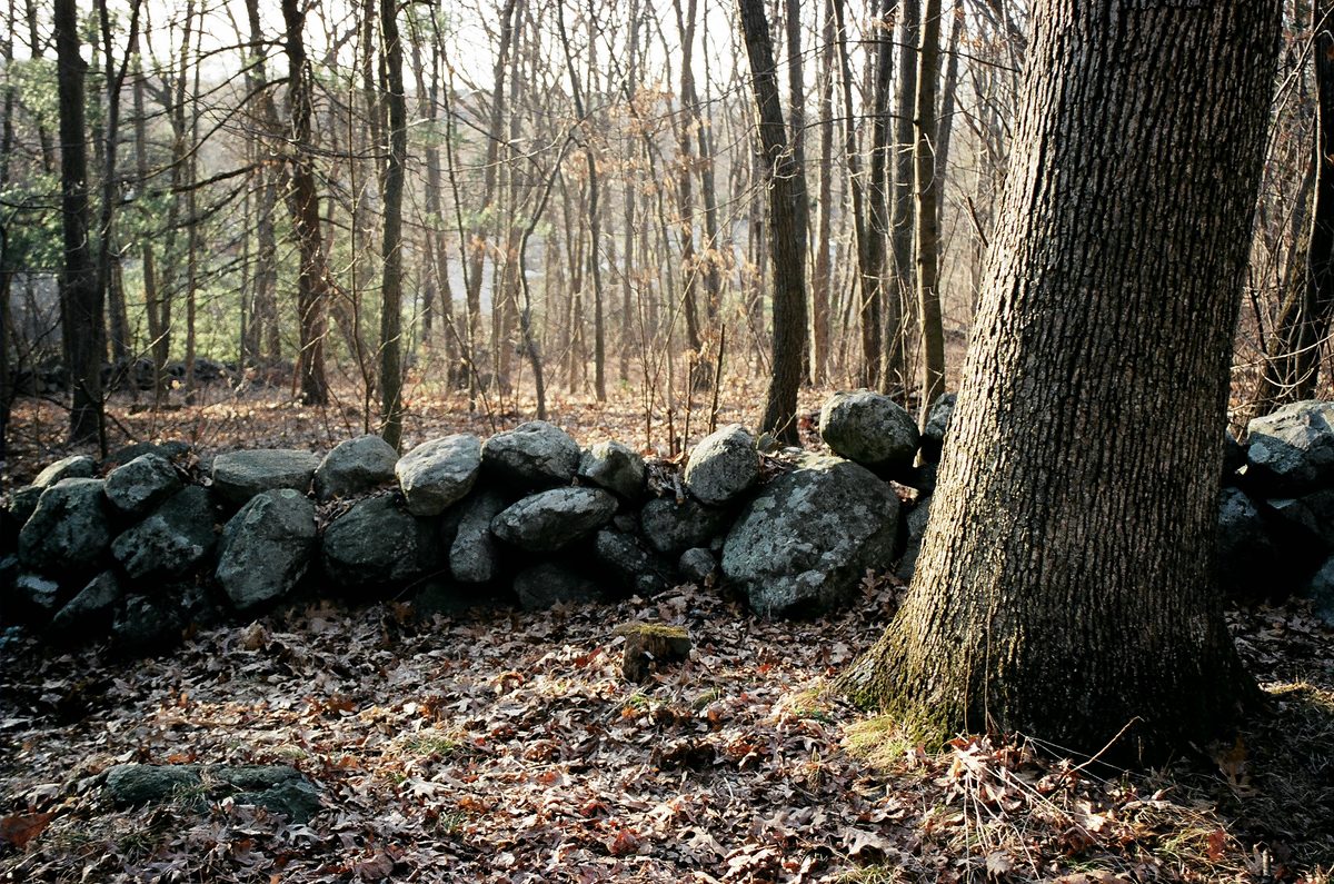
The walls’ new status as heritage objects, which took hold in the early twentieth century, has not been an unmixed blessing. Demand for an authentic-looking old wall has led some to be dismantled wholesale and trucked off to wealthier properties elsewhere, which breaks up the forest habitat the wall had been quietly supporting and strips the stone of the only context that made it historically meaningful in the first place. Local ordinances and incentive programs aimed at keeping walls where they stand have been spreading in response, which is about as close to a happy ending as a pile of fieldstone is likely to get.
Watch the full history
The video version covers the stone boat itself: the tool that hauled this stone to the fence line in the first place, and the farm it helped clear.

Related reading
- The Real History of the Worm Fence
- How Corn Shellers Worked, and Why American Farms Needed One
- What Finding a Red Ear of Corn Actually Meant at a Husking Bee
- How Cream Separators Worked, and Why Every Farm Wanted One
Works cited
- Thorson, Robert M. Stone by Stone: The Magnificent History in New England’s Stone Walls. Walker & Company, 2002.
- Thorson, Robert M. “How Stone Walls Became a Signature Landform of New England.” Smithsonian Magazine, November 14, 2023.
- “History in Ten Steps.” Stone Wall Initiative, University of Connecticut. Link.
- “Frequently Asked Questions.” Stone Wall Initiative, University of Connecticut. Link.
- Gage, James E., with a case study by Mary E. Gage. Field Clearing: Stone Removal and Disposal Practices in Agriculture & Farming, with a Case Study of Stone Removal Activities in Joshua Hempstead’s Diary. Revised & Expanded ed., 2020.
- “Exhibition Note: Stone Walls.” Florence Griswold Museum. Link.
- “Harvesting Spring’s Crop of Stones.” Northern Woodlands, The Outside Story. Link.
- Hussey, Arthur M. Stone Boat or Drag. US Patent 1,055,328, filed September 30, 1907, issued March 11, 1913. Link.
Stone walls are not really a relic. Most of New England’s farmland spent less than a lifetime as open fields before the forest took it back, which means the walls are, by a wide margin, the oldest and most durable thing most New Englanders ever built. They were never meant to be a monument. A farmer stacking them had a field to clear, not a landmark to leave behind.
That the walls outlasted the farms that produced them, and then outlasted the forests that replaced those farms, and are still being mapped and argued over today, is really just a side effect of how little else a farmer could do with a stone that was already in his way. The next time you find one, in a parking lot median or a hundred feet from any trail, has anyone come back to haul it anywhere else?